
The Vagabond Adventure Daily Journal
Where Are We Now?
Good to see you! Hope you’re enjoying the journey!
This journal provides you snapshots of our journey as we work our way around the world, never traveling by jet. It’s a chance to get a close-up view of the planet as we explore it the way people did 120 years ago.
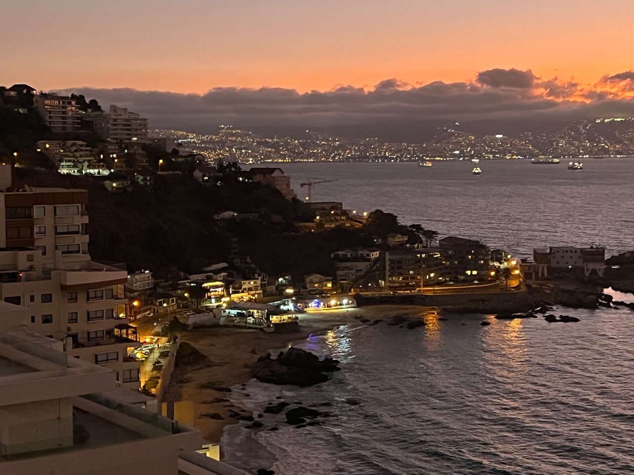
Days 430 - 431 - Vina del Mar, Chile
We arrived in Vina Del Mar, the stepsister and symbiote of Valparaiso. A lovely cliff side town along the Pacific. It was dinnertime and we were looking for seafood. We found it at Restaurante Cochoa but getting there meant dropping down the the cliff side 250 feet and then back up. It was worth it (see seafood and views). The weather is perfect! 50 degrees at night. 70 during the day.
Vina Del Mar is a beautiful beach town next to Valparaiso. Above the Pacific, the steep cliffs hang one high rise after another, too many, I fear. While walking I caught four hang-gliders swooping above. They rode the current for hours. What a view they must have had. The steep hills here and in Valparaiso give Pittsburgh and San Francisco a run for its money. We climbed several to get down to the sea for a bite to eat. Plus walking up and down 300 feet of stairs is a great workout!
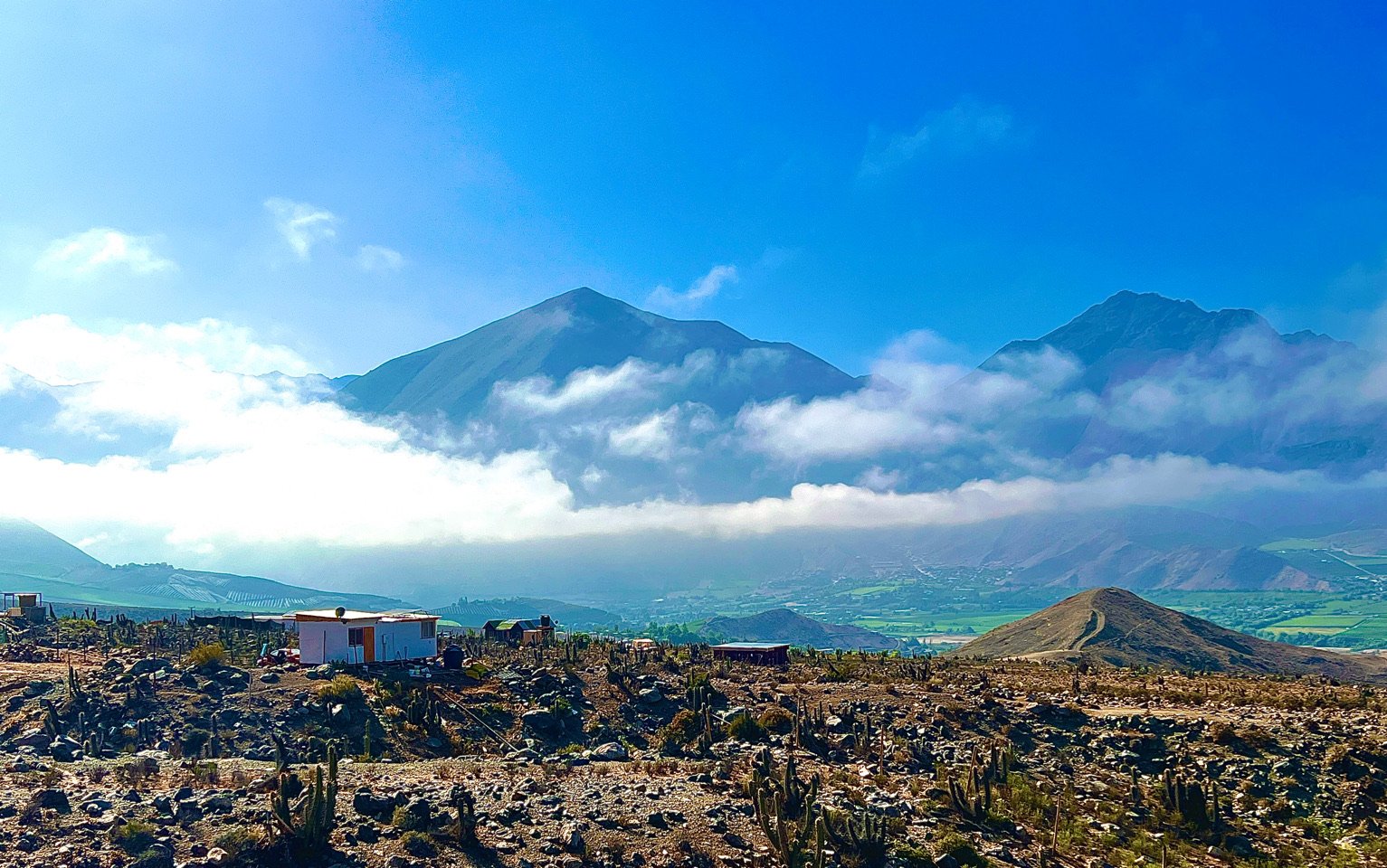
Day 428 - Elqui Valley, Chile
Our bandwidth is severely limited given how remote the mountains are where we are staying. So I can’t send the Choquequirao and Machu Picchu videos I was hoping to get out. But I am hoping I can send these few pictures today. We are just outside the small down of Vicuña adjacent to the Atacama Desert which makes these mountains home to some of the world’s best and most powerful observatories, including Cerro Tololo. I tried to capture this picture of it on a far mountain as the mist cleared at sunrise this morning. When the sun sets at night the skies come alive with stars and we are spending our nights enjoying the show. An app called Stellarium allows you see see the night sky and identify what you see. This screenshot is an example what we saw as we looked at the stargazing sign for Capricorn. When I get more bandwidth I’ll send more.
Our last evening in Vicuña we decided to get an even better view of the night sky and arranged to meet with Victor and Lincoln Alvarez who bounced us and a handful of other stargazers through the mountains to a spit of flat rock where they had set up a motorized 14inch telescope. The starlight was magnificent and we took close looks at the Tarantula Nebula more the 1000 light years in diameter, Orion’s Belt (the middle star is really a nebula), Saturn, Jupiter, the brightest star in the sky-Sirius, a baby at 250 million years old and, course, the moon. See it all is humbling and resets your view of life and the world. Thanks to ElkiMagic.com for setting it up. These images were made available using the the Stellarium App. If you like Stargazing you can down load it from the Apple App Store for free.
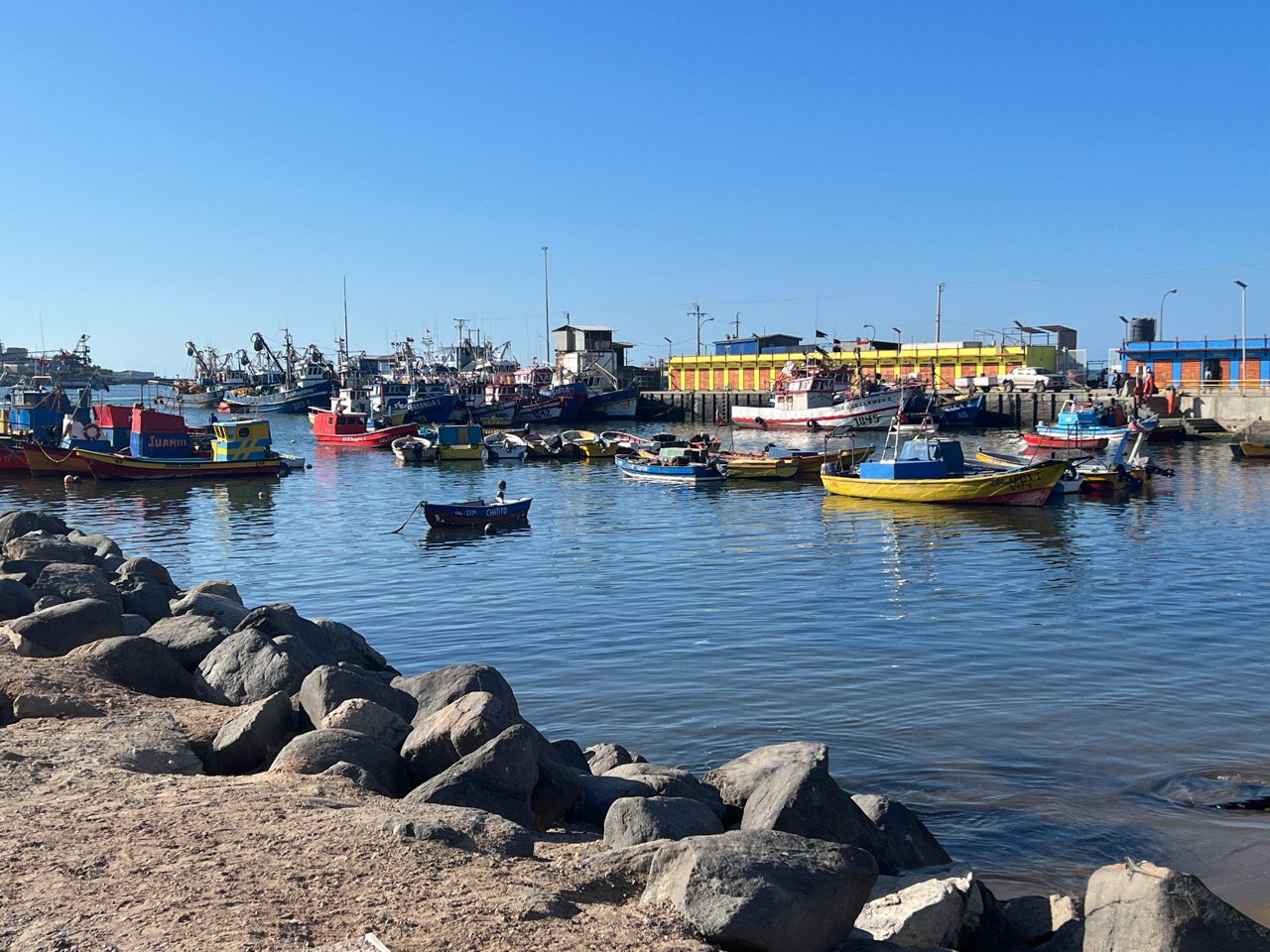
Day 422 - 425 - Caldera, Chile
As we head to the tip of South America (a very long way to go), we wanted to explore one of Chile’s many well known observatories. One of the most famous is in Vicuña, deep in the Atacama Desert. But that’s an almost 12 hour drive so we stopped for Thanksgiving in the small fishing village of Caldera. No Turkey dinner here! But the fish is spectacular and we tried our hand with the Chilean version of chicken fajitas! A very tasty cross between Mexican-American fajitas and Chinese stir fry. In Peru they called it chaufe.
Before departing the sleepy town of Caldera, we found the location of the first train to depart South America. Created by American entrepreneur William (Guillermo) Wheelwright, the train was built to carry ore from the Chanarcillo mine for export from the harbor. The original depot is long gone, but locals are still proud and working to develop it into a tourist destination with this museum.

Day 419 - Antofagasta, Chile
We spent a couple of days in Antofagasta, a city along the Pacific on our way south. It’s a busy port city where copper is mined and then shipped around the world , mostly industrial but with beautiful views of the ocean, barreling waves loved by surfers and high cliffs and mountains. It was a Bolivian city until 1879 when Chile occupied and one obsession in the Latin American War of the Pacific.
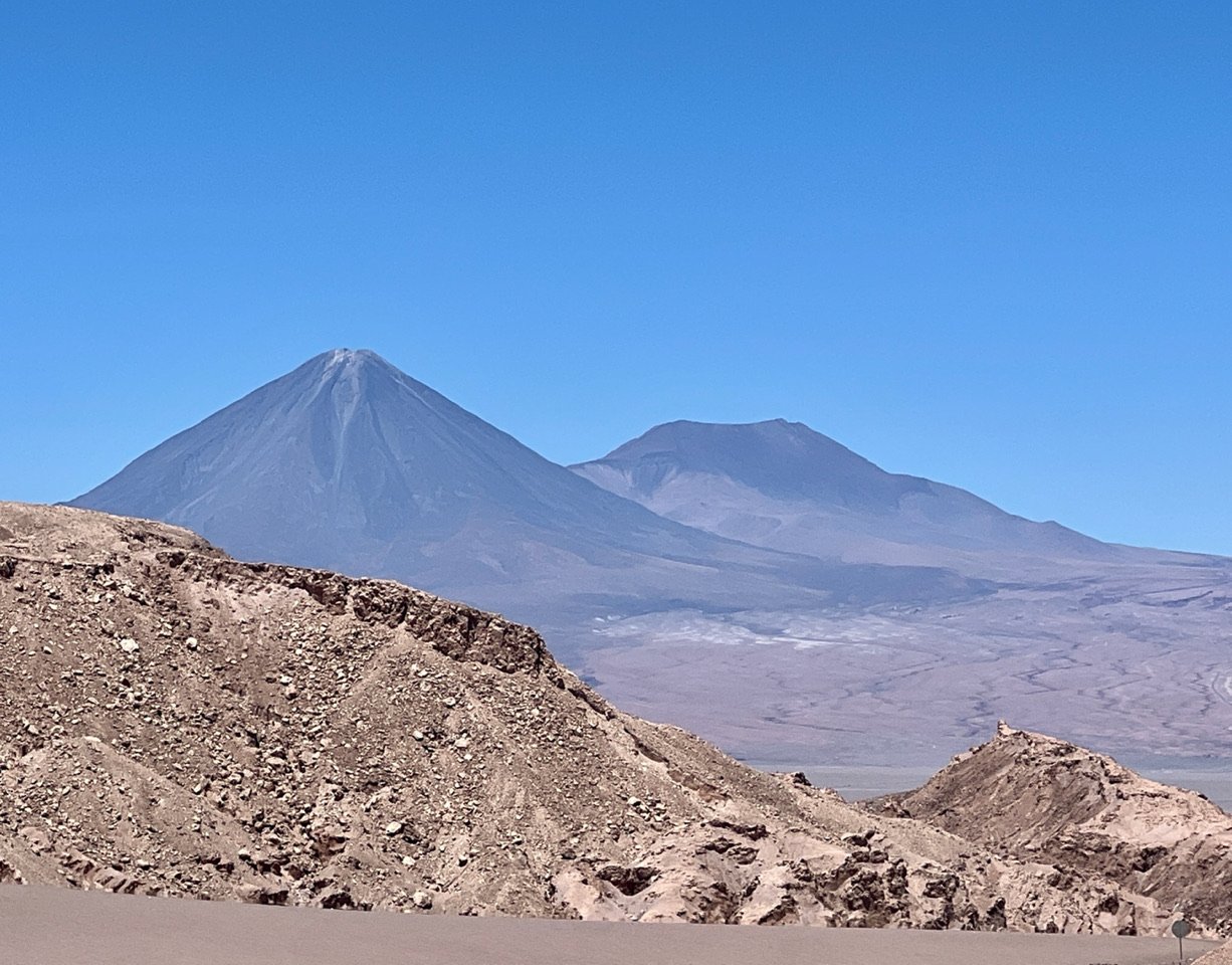
Days 417 - 418 - San Pedro de Atacama, Chile
The terrain between Iquique and San Pedro d’Atacama is desiccated and wild, almost alien. But when we came over this ridge into the Atacama Valley with its sprawling desert and magnificent volcanoes, we were stunned.
Our first full day in the Atacama Desert- the driest place on earth with less than an inch of rainfall per year-we explored Valle de la Luna, the Valley of the Moon so named because of its unearthly landscape. Later we watched the sunset over a portion of the valley called Coyote Point. Some say the name comes from the terrain where the famous battles between Cartoon characters Wiley Coyote and the Road Runner took place (one of my favorites). I have to say, it does look familiar! And terribly beautiful.

Day 416 - Iquique, Chile
We didn’t spend much time in Iquique, but we enjoyed what we saw. A beautiful malecon along the Pacific, with high mountains at its beachfront shoulder. It’s growing fast. Hopefully they won’t over due the development along the coast.
Day 416 - San Miguel, Chile
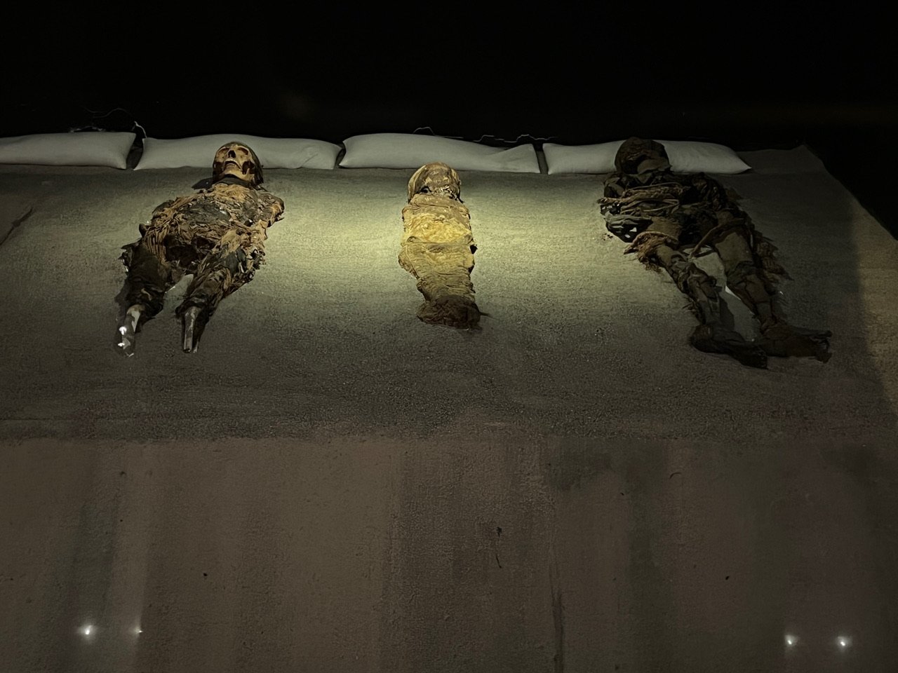
A half hour from Arica is the tiny village of San Miguel with an impressive and growing archeological museum dedicated to the history of Chile including the ancient Chinchurro people who mummified their dead at least 7000 years ago, predating the Eqyptian culture. We found examples of the mummies which have been found through the region where the desert has protected them. The Chinchurro were a long-lived advanced culture that developed along the Pacific and into the desert. I only wish we could have found the locations of the discovered mummies.

Days 412 - 416 - Arica, Chile
We arrived at a small eco-hotel in Arica-the Hotel Apacheta— highly recommended. This was the sunset as we settled into our room and the view of the rocky volcanic coastline outside our door. Heaven. There are also beautiful beaches nearby.
We spent a few days in Arica, enjoying the Pacific, catching up on work, exploring the town a bit. We entered a mall and thought we were in the United States! Almost all US stores. Along the road we saw an Arica version of the Pittsburgh chair 😊. And every day the sunsets were spectacular.
We leave Arica and this beautiful sanctuary with this video of ocean, birds, clams and crab as we next go in search of the mummies of the Chinchorro people of ancient Chile.
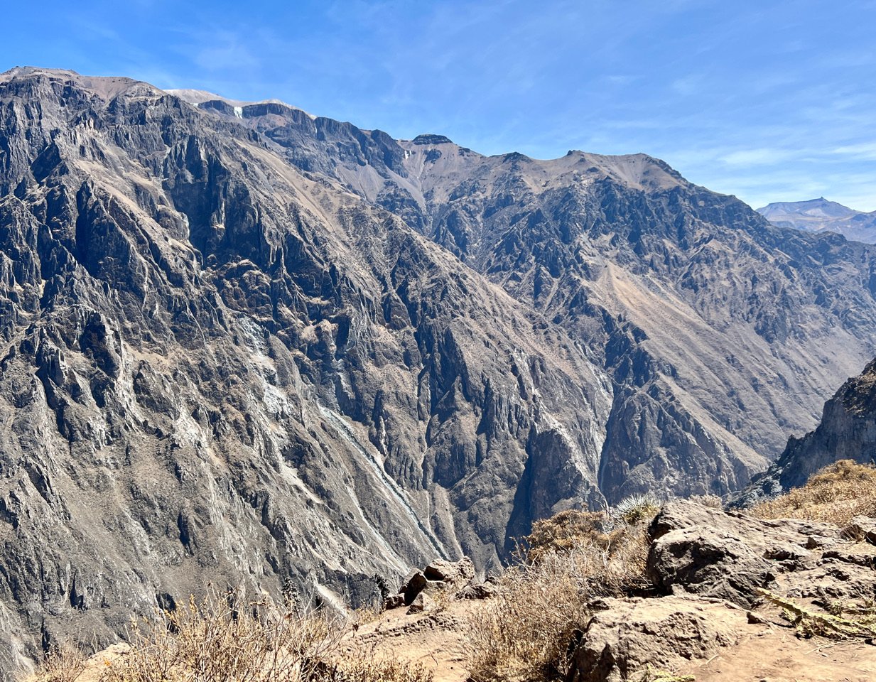
Day 411 - Colca Canyon, Peru
It took a few hours, but eventually our bus wound us deep into the famous Colca Canyon of Peru, well-known for its condors. We didn’t see any (like we did in Choquequirao). But we saw lots of tourists, and ridges of rock unlike anything I had seen since were were in Utah’s Canyonlands (see Dispatch XXII). These steep canyons with their great uplifted shards of rock were magnificent.
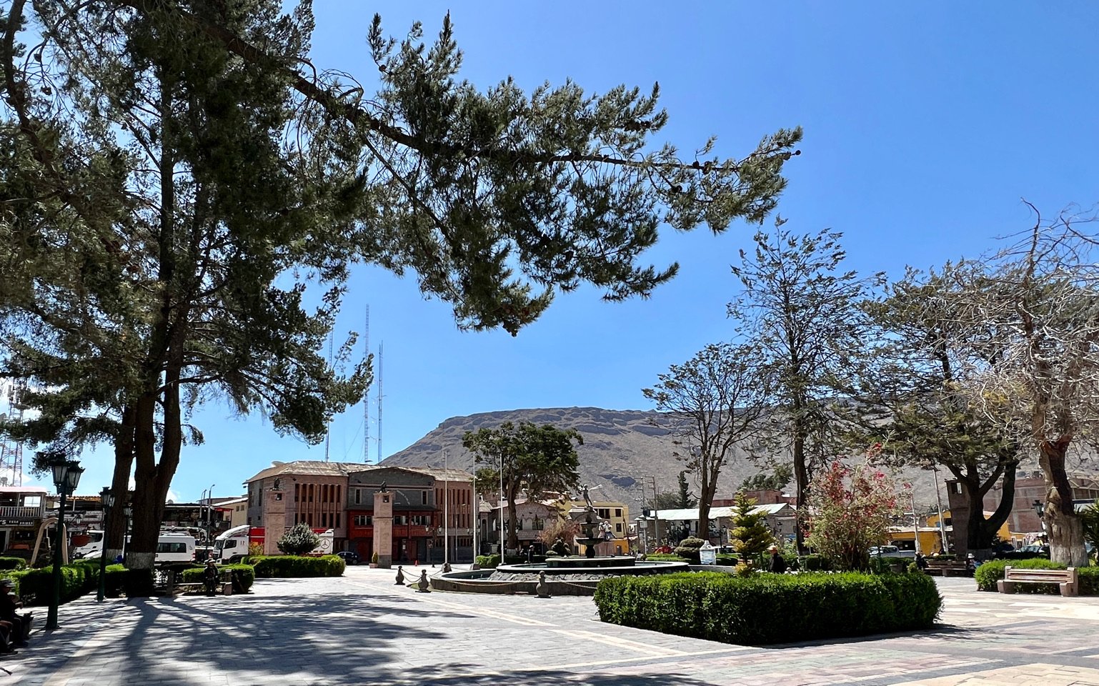
Day 410 - Chivay, Peru
On our way from Puno to Colca Canyon, one of the largest canyons in the world, we stayed in the charming little town of Chivay.
Local trees gnarled, bending in all directions arose around and above as a hard boned man in his 70s insisted on carrying out bags to our cabin. I got the name of the tree from Joao at the reception desk, and then lost it. It’s probably among the many shreds of paper and notes I have. It will turn up.
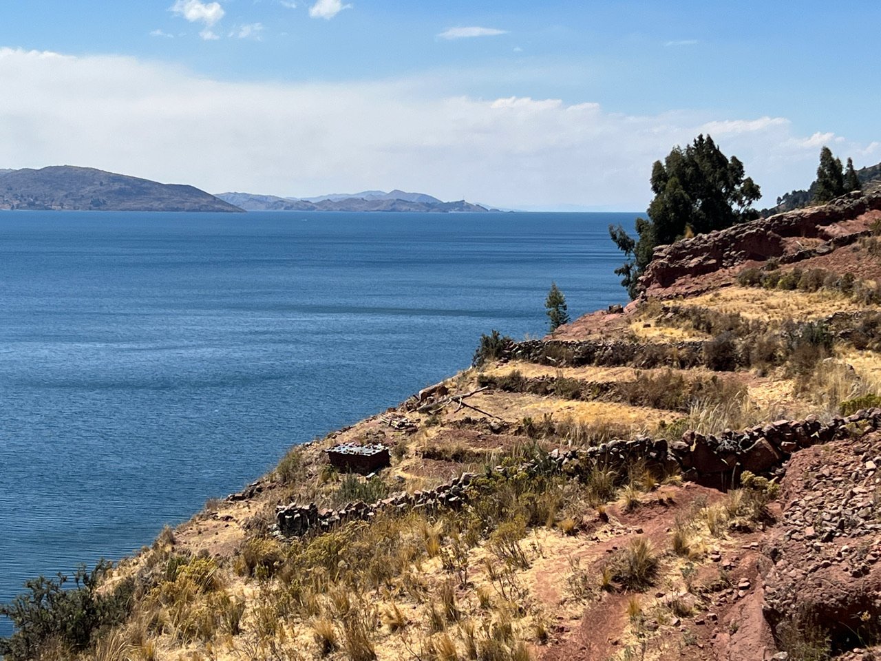
Day 408 - 409 - Lake Titicaca, Peru
The Uros people of this Lake call it Titihaha-meaning strong puma because they felt the lake was in the shape of a puma. They are a pre-Incan culture that came here 1000 years ago. 300 years later, a contingent broke away and created these entirely man made islands constructed from the ubiquitous reeds that rise from the low water nearby. There are about 80 small islands, each with a kind chief who advises the peoples’ mayor. The system is run like a democratic co-op. It’s an ancient but remarkably clever system that as served longer than many Empires have.
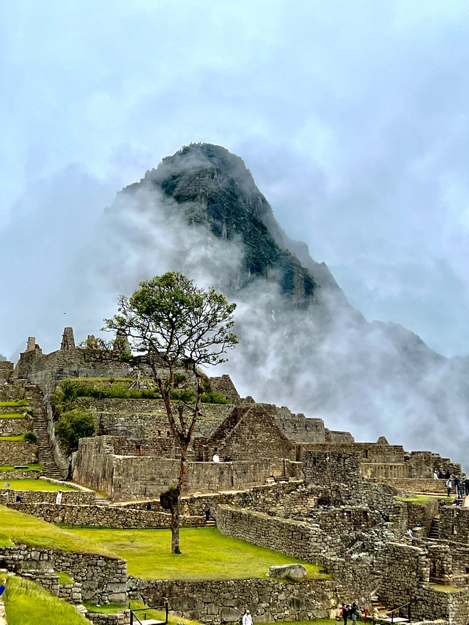
Day 404 - From Machu Picchu to Cusco
Our 6th day on our Choquequirao/Machu Picchu journey we awoke to take a bus to the famous palace. (See video.) Unlike Choquequirao, long lines awaited us — one bus after another. Millions visit here annually. Above us lay the mountain of Machu Picchu, enshrouded in mist. Once on the grounds we could see nothing and I worried we’d be unable to share this stunning place. But slowly the clouds disappeared and like a show the citadel revealed itself. The location is so dramatic because the palace sits immediately beside three high mountains and a deep ravine created by the Urubamba river far below.
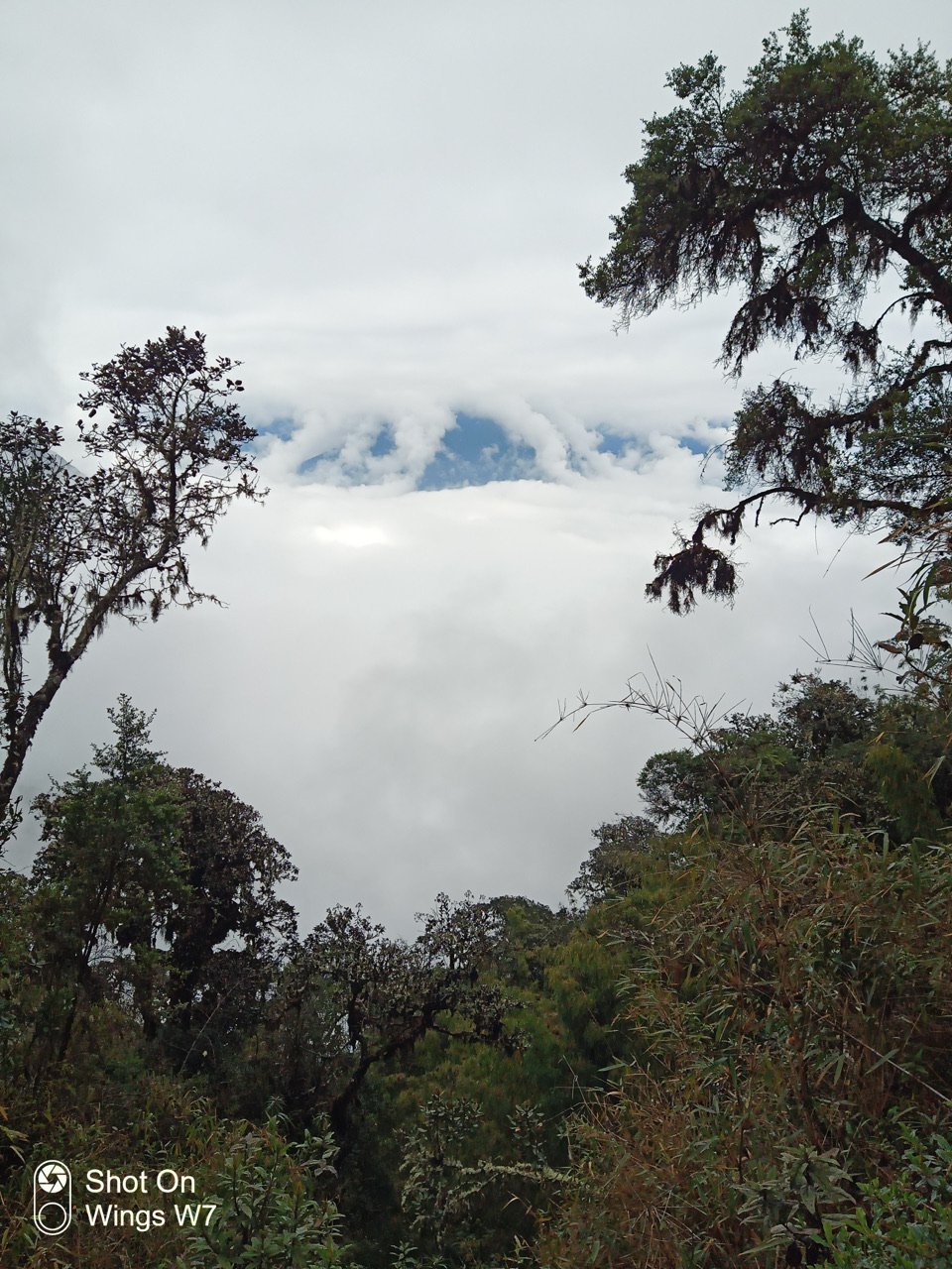
Day 401 - 403 - The Hike from Choquequirao to Machu Picchu
Day 4 of the Choquequirao/Machu Picchu Hike. We came down the highest mountain on foot after a steep morning ascent and eventually reached the tiny town of Santa Teresa above the Totoro River. My video reveals a bit of the location. That’s our tent and the toilet. Lovely! The next morning we planned to get a ride to the trailhead to Machu Picchu, but the driver didn’t show. So we spent some time in the village. Cyn caught me and Renato having coffee in the little kitchen where a young woman brewed the coffee. More to come.
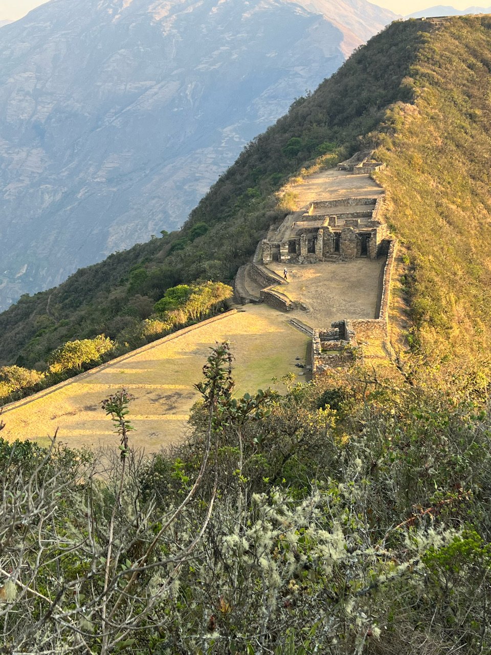
Day 400 - Arriving at Choquequirao
Day 2 on the trek to Choquequirao: big day because we will actually reach the sacred city. We hope. That’s the mountain we will climb, the big one with the on top. (I’m still working on the proper names of all the mountains. There no shortage of them.) Choquequirao is near the top in the crevice to the left, just below the clouds. We had some breakfast with Mariano our cook and Renato, the owner of CuscoNative.com-highly recommended, mention my name), and then started down those rocks and finally made the Rio Apurimac. I wondered if we’d ever get there. Once there we took a breath to enjoy the surroundings and the roar of the river. Not many human beings to be found here. Then we began the roughly 6500 foot vertical ascent to the citadel.
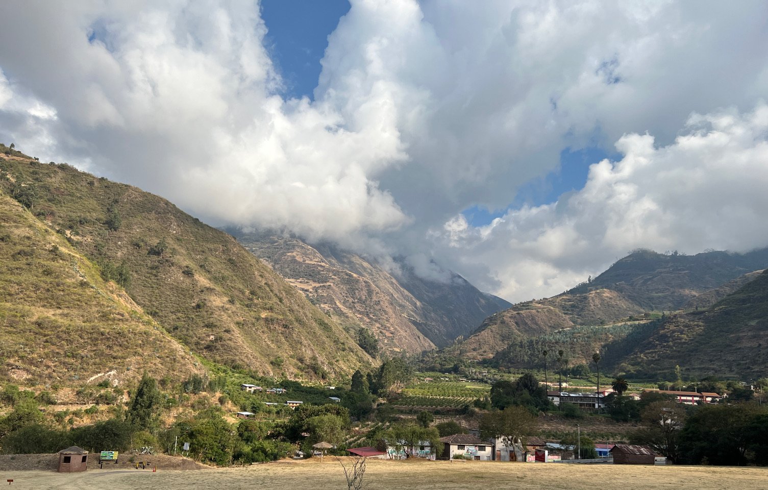
Day 399 - Beginning the Trek to Choquequirao
We drove away from Cusco along the Apurimac River through its flatlands toward our trailhead, but first stopped at Tarawasi where an ancient Incan Marketplace still stood among a small farm. Tarawasi was on a direct line from the high mountains of Choquequirao to this central village onto what is now Nasca near where saw the Nasca Lines. A theory is that the village acted as a way station where repairs were made, goods were replenished and where couriers would run fresh fish from the sea up to the mountains through miles of brutal terrain. The photos reveal the intricate and refined stone work the Incas were capable of. Even now, 700 years after these buildings were built, you couldn’t fit a piece of paper between these stones. It was as if they were laser cut.